A Community of Apple iPad, iPhone and Mac UsersUp to gallery
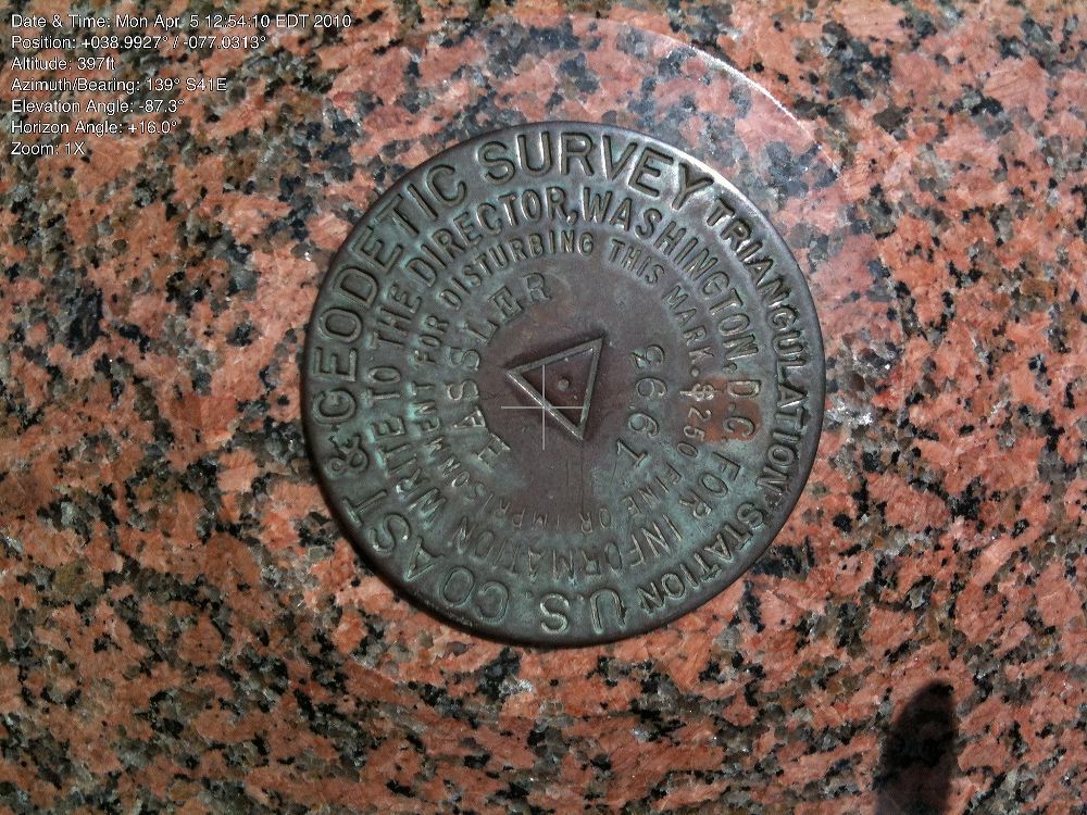
Figure3-theodolite.JPG
Figure 3: The Station Hassler survey marker, shot from directly overhead with Theodolite. Overwritten on the image is the time and date, a position of +038.9927º, -077.0313º, an altitude of 397 feet, azimuth/bearing of 139º S41E, elevation angle of -87.3º, horizontal angle of +160º, and no zoom. There are slight differences in how the information is displayed from the earlier photo of the Pi offices (Figure 1), taken four months earlier, thanks to updates from the publisher. (Photo by Lawrence I. Charters)